City of Toronto Addresses Lists: Ward 1 - 47 Data
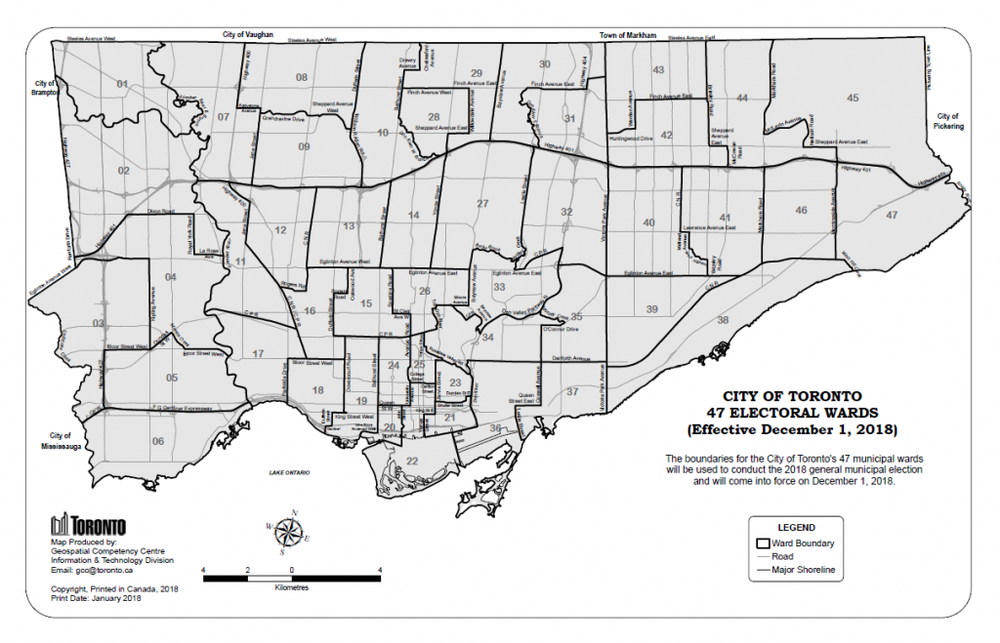
City of Toronto’s New Ward Boundaries
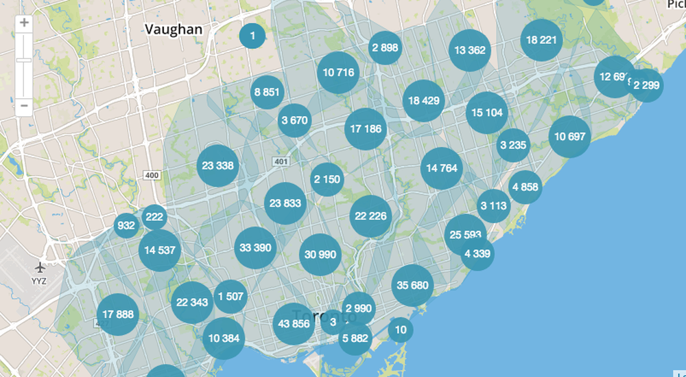
City of Toronto Address Map

Example Ward Address List Spreadsheet
Summary
Download City of Toronto addresses by new ward boundary. Addresses from the City of Toronto Open Data Catalogue have been geocoded to append postal code. Note that no building apartment, unit or suite numbers are included.
Have questions or comments? Post them to the Q&A forum. Files are free to copy and modify under a Creative Commons Attribution-NonCommercial (CC BY-NC) licence.
| Google Drive | View the resource |
More Information
View the original City of Toronto Open Data Catalogue Address Point resource. Addresses have been geocoded to append postal code and may contain errors. Lists are recommended for canvassing walk sheet generation rather than mass mailings.
Column name (Description)
======================================
EXTERNAL_ID (Unique ID)
FULL_NAME = PLACE_NAME (if exists e.g. churches, schools, parks etc.)
Address fields:
- primary_address1: (Street address)
- primary_city: (City)
- primary_state: (Province)
- primary_zip: Zip code (appended)
- primary_country_code: (Country code)
- primary_country: (Country)
Appended districts based on geocoded address:
- federal_district: (Federal riding)
- state_upper_district: (Provincial riding)
- city_district: (New City of Toronto Ward Boundary)
GEO_ID = ADDRESS_POINT_ID (unique geographic identifier)
LFN_ID = LINEAR_NAME_ID (the street name identification number)
LINK = CENTRELINE_ID (link to geo_id of the primary address)
FCODE = GENERAL_USE_CODE (Feature code number)
FCODE_DES = GENERAL_USE (Feature code description)
CLASS = ADDRESS_CLASS_DESC (Address classification (primary, structure, entrance address etc.))
LONG = LONGITUDE (Longitude in WGS84 Coordinate System)
LAT = LATITUDE (Latitude in WGS84 Coordinate System)
WARD_NAME = WARD_NAME (Former Ward Name)
| Author | City of Toronto |
| Section | Campaign |
| Modules | Data |
| Keywords | open data |
| Topic ID# | 34 |